
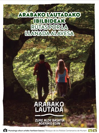
NATURE

GREEN NATURE
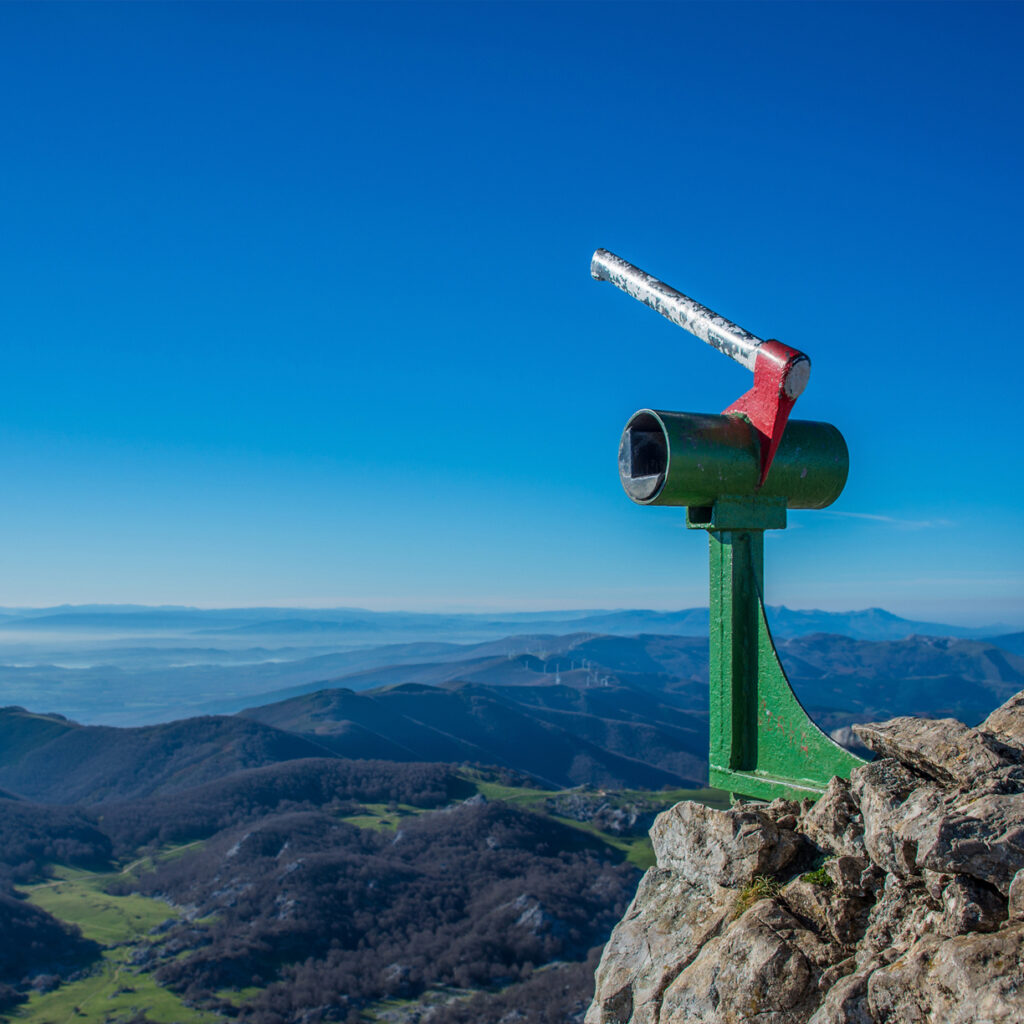
Aizkorri-Aratz Natural Park
This space includes a large mountain range sprawling east to west, home to the tallest peaks in the Basque Country (Aitzuri, 1,550 m). They are also the border between the peaks of the Cantabrian and Mediterranean, as well as the border between the provinces of Álava and Gipuzkoa.
The majority of the substratum is comprised of Urgonian limestone, whose erosion creates spectacular karsts: crests, sinkholes, depressions, limestone pavement, cliffs, etc. These include famous spots including La Lece cave, San Adrián tunnel, Urbia depression, Arantzazu precipice, etc. The substratum changes in Elguea-Urkilla, where sandstone and clay appear, resulting in a landscape with round, rolling slopes.
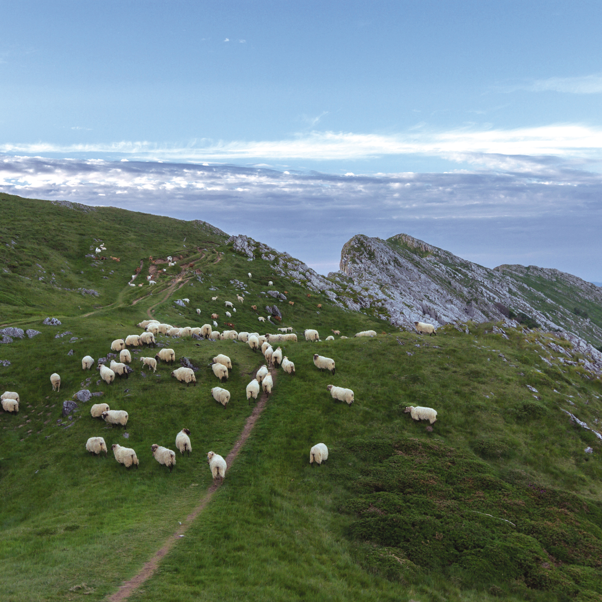
The Natural Park offers magnificent and extensive specimens of indigenous forests: beeches, sessile oaks (Quercus petraea), etc. The highest parts of the mountains have fewer trees and mountain clearings teem with heath, the product of intense latxa sheep grazing in these mountains.
The park is part of the Family Tourism Club of Euskadi. Its website contains information, ideas and plans to help you enjoy nature with your family.
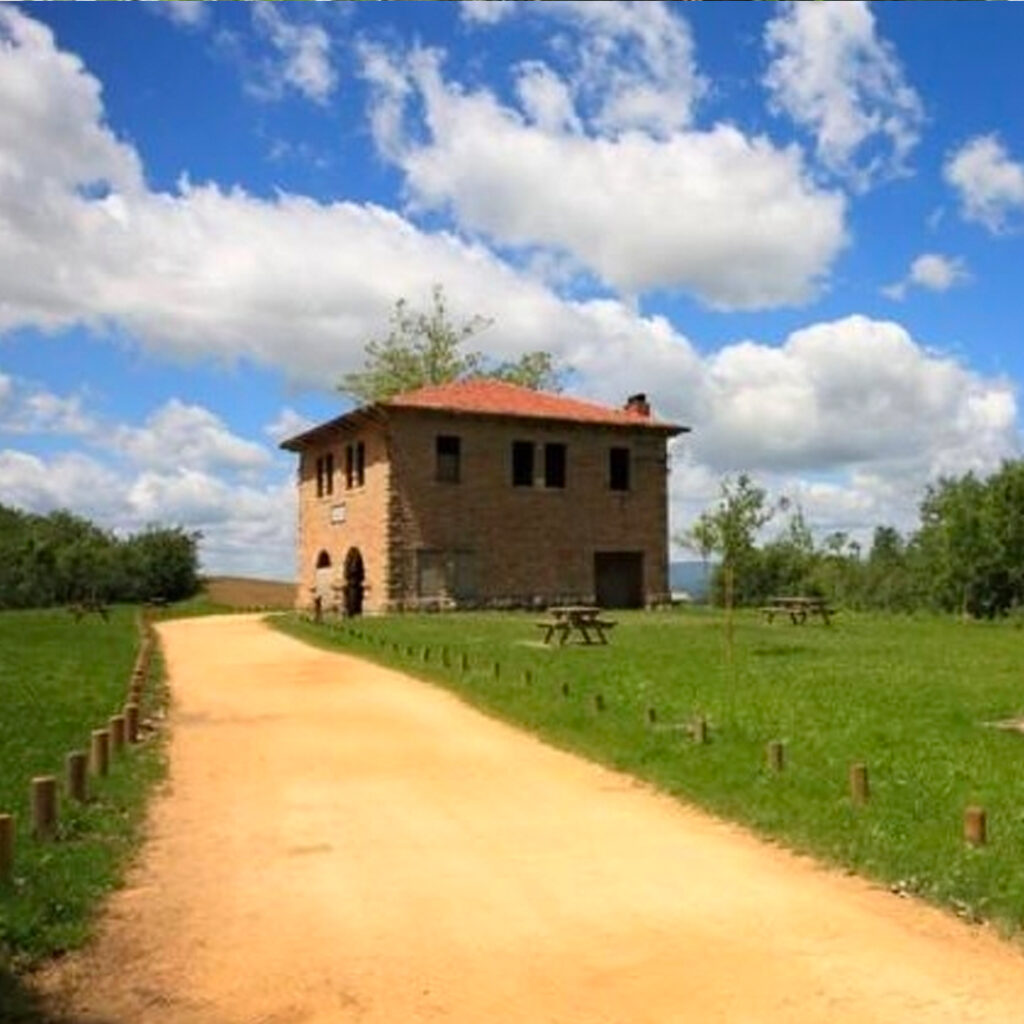
You’ll find the Information Centre at the old San Pedro power plant in Araia. Inside, a very clever European edible dormouse (Glis glis), known in Basque as mitxarro, acts as a guide and will teach you about the heritage and importance of the nature of the area.
A path starts at the building and goes into the Alavese side of Aizkorri Natural Park and in than less one hour, it will take you to the beautiful source of the Zirauntza river.
You’ll also find one of the most beautiful industrial landscapes of the Basque Country in this park: the Ajuria and Urigoitia industrial forest, dams, forests, coal cellars, warehouses, and more. It is one of the country’s first foundries, located at the park entrance, a place where nature and industry are inseparably intertwined.
Details of Interest
Hours: the park is always open, but the visitors’ centre has opening times
Guided tours: The park periodically organises activities and guided tours. You can see the calendar here.
More information
Aizkorri-Aratz Visitors’ Centre
Intuxi Kalea, 48 – Araia
Tel: 0034 945 38 69 64 – 0034 688 629 932
- Included in the Euskadi Code of Ethics Register
- Family Tourism Club of Euskadi
parketxe.aizkorriaratz@gmail.com
https://aizkorriaratzparkea.eus/es/inicio
Downloads
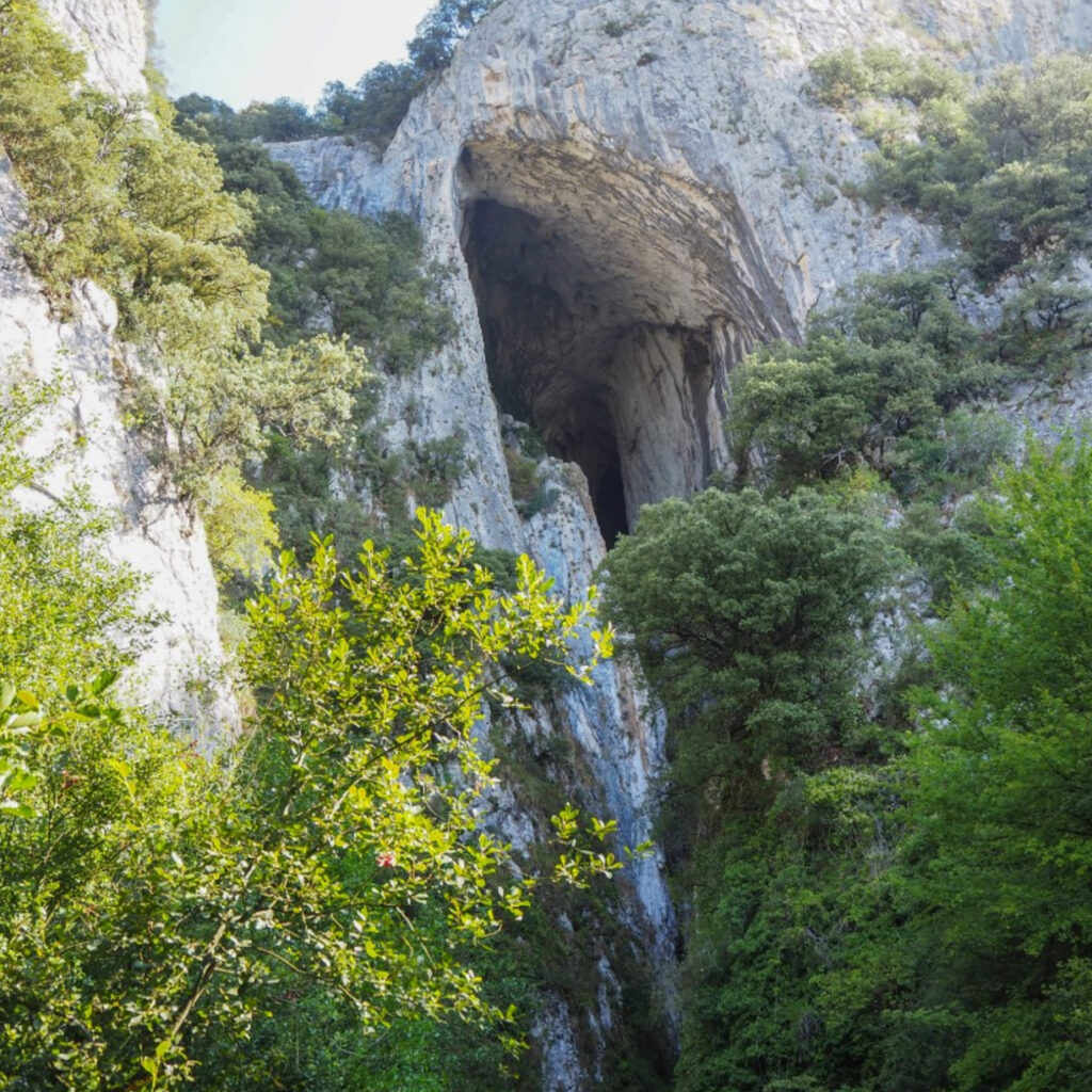
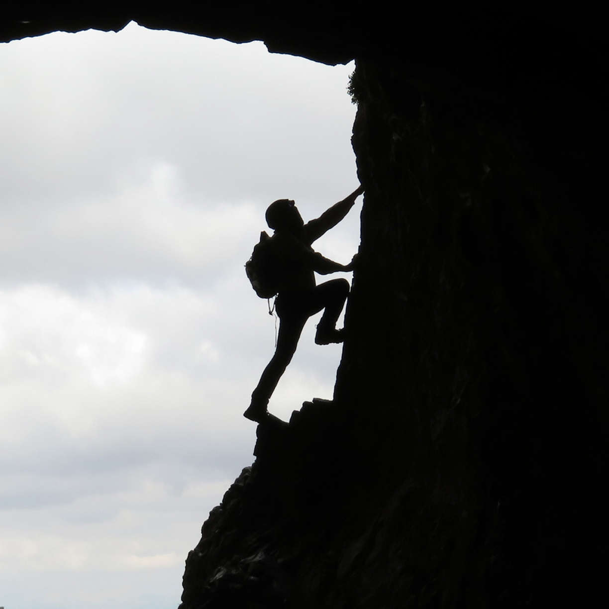
La Leze Cave
In the southernmost area of Aizkorri-Aratz Natural Park, just a few metres from a recreation area, you’ll find the astonishing La Leze Cave.
This immense 70 metre tall cavity was created over the course of millions of years by the passage of the Artzanegi stream and it is an amateur adventure athlete’s delight, especially for rock climbers.
Inguru Abentura organises canyoning trips into La Leze Cave and was the winner of the 26th Active Tourism Contest, FITUR 2021.
Details of Interest
Hours: always open.
Guided tours and activities: Inguru Abentura organises canyoning trips into the Cave and rock-climbing trips in Egino.
More information
Aizkorri-Aratz Visitors’ Centre
Intuxi Kalea, 48. Araia
Tel: 0034 945 38 69 64 – 0034 688 62 99 32
parketxe.aizkorriaratz@gmail.com
Natura 2000 Network Areas
Special Areas of Conservation (SAC) are environmental areas pivotal to conserving biodiversity. They were selected by the member states of the European Union as part of the Natura 2000 Network.
Aizkorri-Aratz SAC
The Aizkorri-Aratz SAC includes the land located at the border between Gipuzkoa and Álava, at the south of Gipuzkoa and the territory in Álava belonging to the municipalities of Asparrena, Zalduondo and San Millán.
This includes Euskadi’s tallest summit, Aitxuri. The rocky mass is covered on the sides by fields and pastures. It is home to one of the largest beechwoods in the Autonomous Community of Euskadi. Some of the creatures inhabiting this space include a large number of birds of prey and what is probably the largest variety of bats in the Autonomous Community.
Island of Alavese Plains Oaks SAC
Island is the name for the thickets of pedunculate oak throughout the Alavese Plains, a testimony to the vegetation of the past. These islands are shrinking due to human activity.
These places are highly biodiverse, and some of the species found here are threatened. Given their important ecological function, they have been declared Sites of Community Importance, whose preservation is a priority.
Barrundia River SAC
The Barrundia river begins in the Urkilla mountains, which are in the north-western section of the province of Álava and flow out into the Ullíbarri-Gamboa reservoir.
Its banks are home to a large forest comprised mainly of alder and ash trees. European minks, one of the most threatened carnivores in Euskadi, live in this forest, so its conservation is a top priority.
Arakil River SAC
The SAC includes the basin of the Arakil river from Albéniz to the border with Navarre. This section is quite important as it connects the centre and the east of the Alavese Plains, where a number of European mink populations live.
Aldaia Mountains SAC
To the east of the Ullíbarri-Gamboa reservoir, between the Barrundia and Zadorra river valleys, tower the Aldaia Mountains, presided over by Gebara Castle.
Its holm and gall oak covered slopes are home to many birds of prey and mammals, as well as a number of species of beetles of community interest, including the only population of hermit beetles in Euskadi.
Zadorra System Reservoirs SAC
Located in the heart of the Alavese Plains, to the north of Vitoria-Gasteiz, lie the Urrúnaga and Ullíbarri-Gamboa reservoirs, built to supply potable water to much of the Autonomous Community.
They serve an important function for breeding, migration and hibernation for aquatic birds. In the region of Salvatierra, on the banks of the Ullíbarri-Gamboa reservoir, you’ll find Garaio Provincial Park and Mendixur Birding Park, two perfect places for birdwatching and enjoying some time in nature.
Entzia SAC
Place of regional importance Entzia includes the areas of Entzia and Iturrieta, extending west to the Bitigarra and Arburu mountains and north into the lands between Opakua and Vicuña.
This space is especially of interest in terms of nature due to the beech woods, gall-oak groves and pastures inhabited by species important to the community. We also cannot overlook the archaeological assets here, a place where humans have been living for thousands of years.
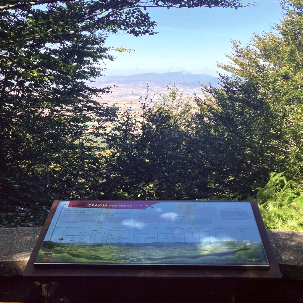
Opakua Lookout Point and Mirutegi Cross
A few metres before the top of Opakua pass, a narrow marked path will bring you to this small lookout point overlooking the plains.
From here you’ll have an amazing view of the heart of the Alavese Plains: a mosaic of fields, small population centres, the Ullíbarri-Gamboa reservoir and the towering Gorbeia and Aizkorri Natural Parks. On clear days, you’ll even be able to make out the silhouette of the Salvada mountains in the distance.
If you delve into the Entzia mountain range, you’ll also find the Mirutegi: a remarkable natural balcony with privileged views of the plains.
Details of Interest
Hours: always open
Guided tour: NA
More information
Alavese Plains Tourism Office
Calle Mayor, 8 – 01200 Agurain/Salvatierra
Tel.: 0034 945 30 29 31
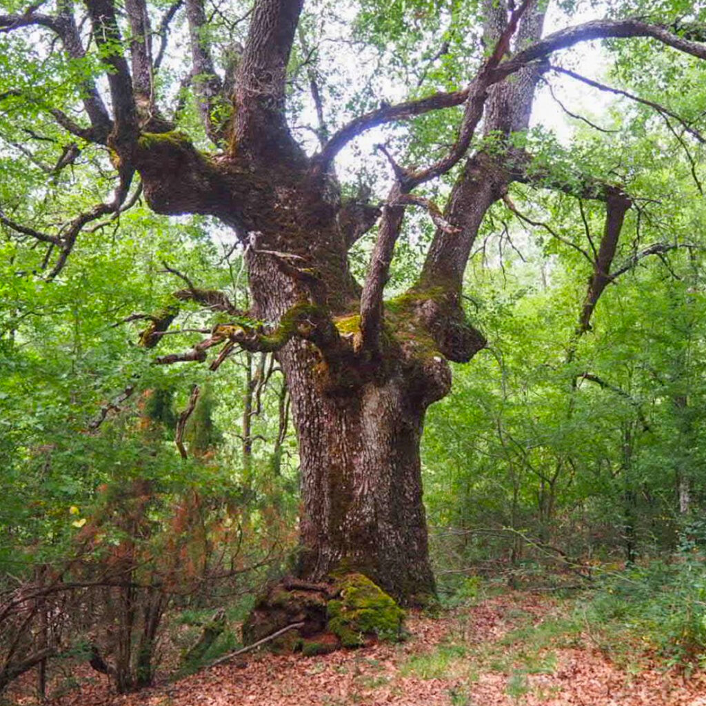
Centuries-old oak forests of Munain
Just a few minutes southeast of the towns of Okariz and Munain, you’ll find one of the greatest natural treasures of the Alavese Plains: the centuries-old oak forests of Munain.
In Galarreta and Zalduondo, for their part, you’ll find pollarded sessile oaks (Quercus petraea), trees that have been pruned to disproportionately thicken their trunks. The trees were pollarded to extract coal and allow livestock to graze beneath them.
Around 600 trees are hundreds of years old, many of them in excellent condition. These kinds of forests favour biodiversity and are home to many rare plant and animal species.
These places are highly biodiverse, and some of the species found here are threatened. Given their important ecological function, they have been declared Sites of Community Importance, whose preservation is a priority.
Details of Interest
Hours: always open
Guided tour: NA
More information
Alavese Plains Tourism Office
Calle Mayor, 8 – 01200 Agurain/Salvatierra
Tel.: 0034 945 30 29 31
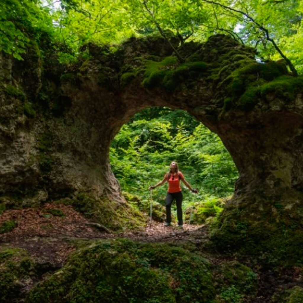
Entzia Mountains - Legaire Fields and Arno Labyrinth
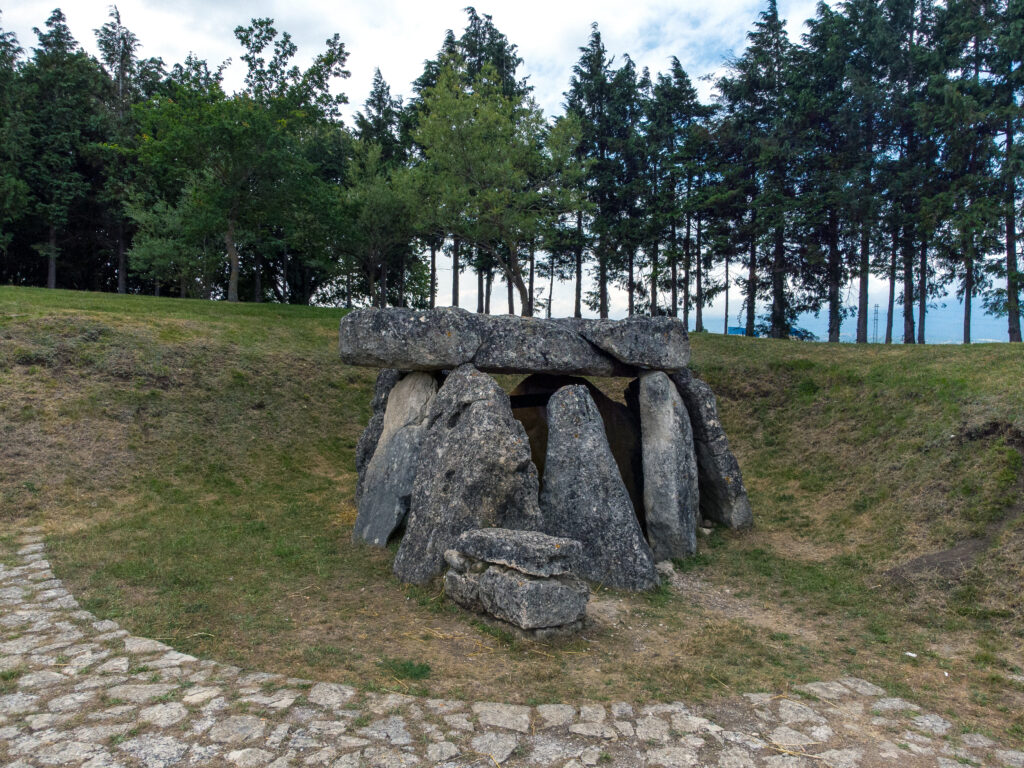
In the middle of the Entzia mountains, Legaire is an approximately 6 km karst valley spectacular to behold. The park boasts a number of burial mounds, dolmens, menhirs and prehistoric rocks. The Mendiluze stone circle is the most well-known.
A walk around the Legaire fields is an opportunity to discover curious shapes sculpted by nature, like the Arno labyrinth. This karst created by water invites visitors to lose themselves in its twists and turns.
Getting to the labyrinth is easy: simply start in Alemanes car park and head north. You’ll also pass another labyrinth, Katarri.
These fields offer spectacular views of the western portion of the Alavese Plains. Don’t forget to see the Mirutegi cross!
Arno labyrinth: GOOGLE MAPS
Legaire fields: GOOGLE MAPS
Details of Interest
Accessibility: there are several routes to the Arno labyrinth, but the easiest goes from the Alemanes car park. Park in the Legaire car park to easily reach the Legaire fields.
Hours: always open.
Guided tour: NA.
More information
Alavese Plains Tourism Office
Calle Mayor, 8 – 01200 Agurain/Salvatierra
Tel.: 0034 945 30 29 31
BLUE NATURE
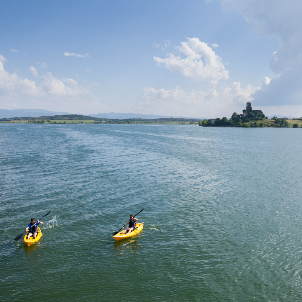
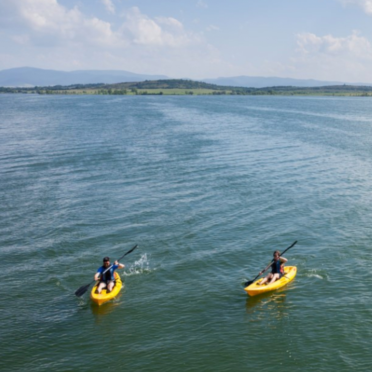
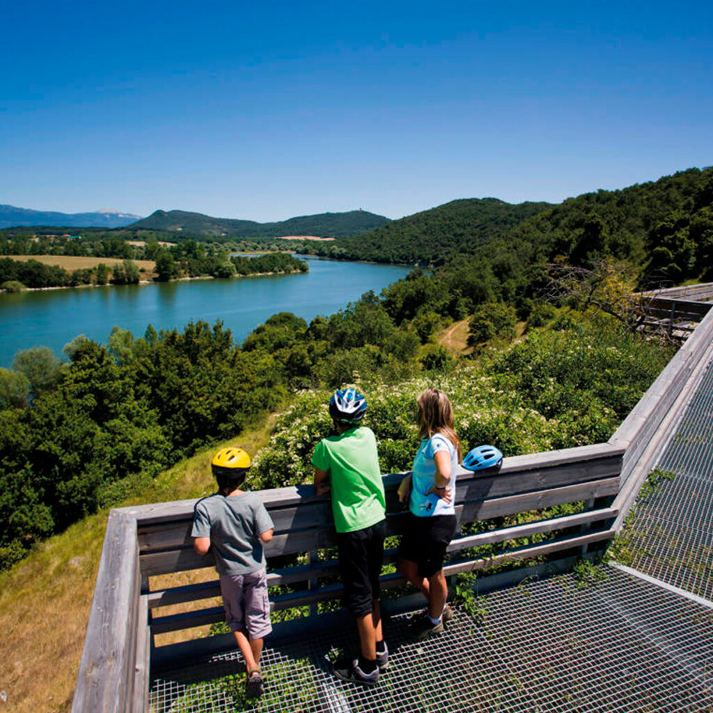
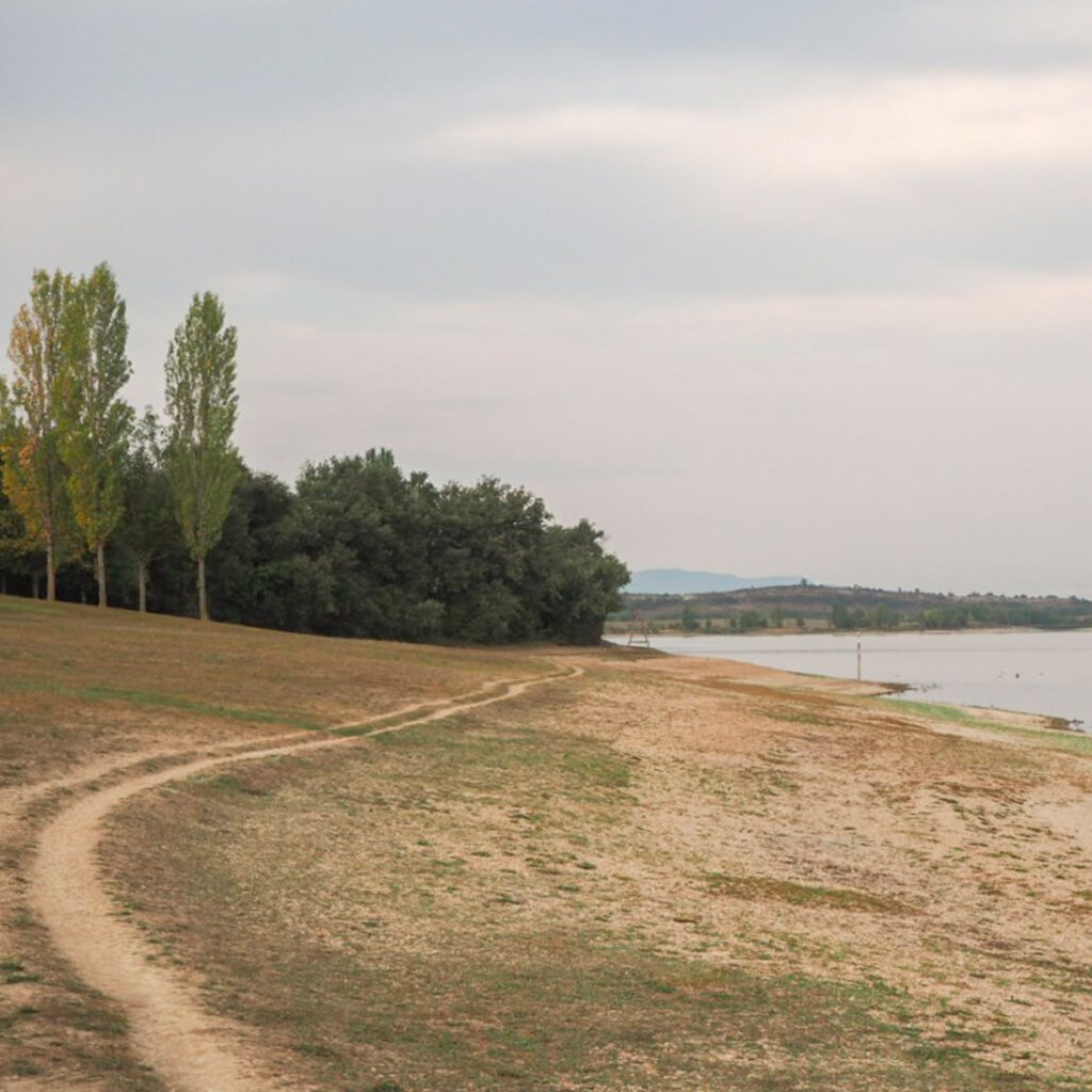
Garaio Provincial Park
Garaio Park borders its ancient namesake, a village on the banks of the Ullíbarri-Gamboa reservoir. Garaio is a small 116 hectare peninsula jutting into the reservoir at the mouth of the Zadorra river.
Located at the edge of the waterline with gentle slopes and expansive clearings peppered with thickets, it is an appropriate enclave to experience nature and learn to care for, preserve and love it. Blackthorns, common hawthorns, single-seeded hawthorns, maples, ash trees, storks, robins, jays, great tits, wagtails, butterflies, badgers and hedgehogs are a few examples of the flora and fauna able to be enjoyed here.
You’ll also find Mendixur Birding Park, a strategic birdwatching site, where you’ll find a variety of species inhabit the wetland year-round.
The park is surrounded by artificial beaches and is a great place to unwind, exercise or learn about the environment.
It has an internal network of roads and car parks guaranteeing comfortable and easy access, and it also boasts well maintained public facilities (information office, marked trails, lookout points, water fountains, bathrooms, beaches, showers, etc.) making leisure activities a breeze.
Spotting the wild flora and fauna, walking or biking, nature photography, guided tours, workshops, kite flying and swimming are just a few things you can do in Garaio.
There are two free car parks exclusively for caravans and motor homes in Garaio:
1. Daytime parking inside the park (8:00 am to 11:00 pm)
2. 24-hour parking, next to the park entrance
Details of Interest
Fresh water beaches
Hours: the park is always open, but the Garaio Information Office has its own hours, which can be consulted here.
Guided tours: The park periodically organises activities and guided tours. You can see the calendar here.
More information
Garaio Information Office
Garaio Auzoa, 1. 01206
0034 695 78 24 98
https://ullibarri-gamboa.araba.eus/
Downloads
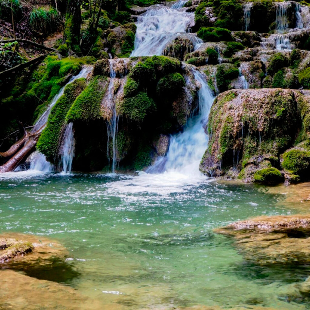
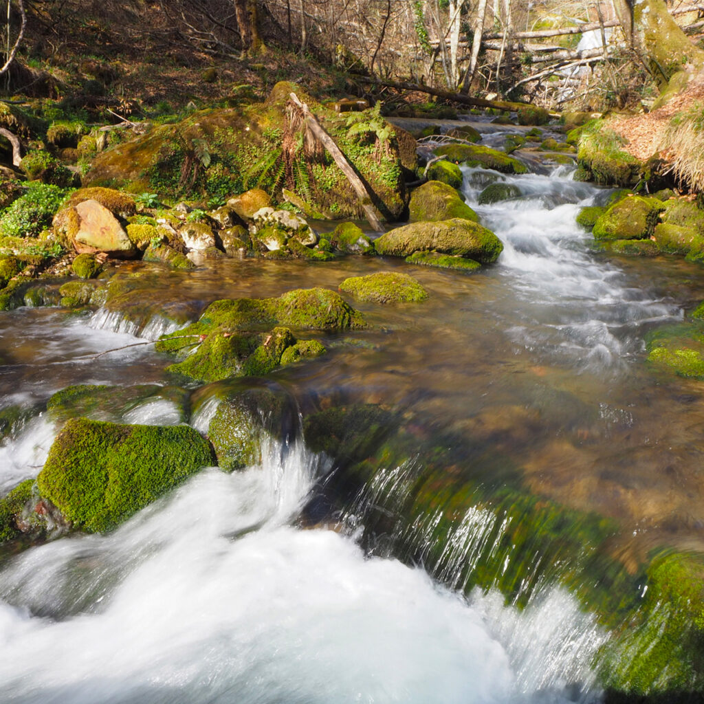
Tobería Falls
This 1.5 km route starts in Andoin and leads to the beautiful Tobería Falls, a remarkably beautiful set of waterfalls.
The route begins from the plaza in Andoin. Set foot by following a street that later turns into a concrete path leading to an old mill on the right-hand side of the river. Shortly thereafter, cross the small footbridge over the river. In approximately 300 metres, you’ll reach a fork in the road and veer left after going through a metal barrier. Don’t forget to shut it behind you!
Later there is another fork in the trail. Head right and leave the other path to the left, which follows the edge of a livestock enclosure. In about 200 metres, you’ll find another fork in the road. Go left and you’ll need to go through another metal barrier in a few metres. From there, you’ll follow the track surrounded by centuries-old beeches and oaks to the source of the river. There, you’ll find a small water wheel and a catchment. If you cross the river and follow the small trail down the right-hand bank, you’ll reach the source of the river.
If you do this route during the rainy season, you’ll come upon several waterfalls in this last section, some of them quite stunning. Go back the way you came.
Details of Interest
Waterfall, trail.
Hours: always open
Guided tour: NA
More information
Alavese Plains Tourism Office
Calle Mayor, 8 – 01200 Agurain/Salvatierra
Tel.: 0034 945 30 29 31
Downloads
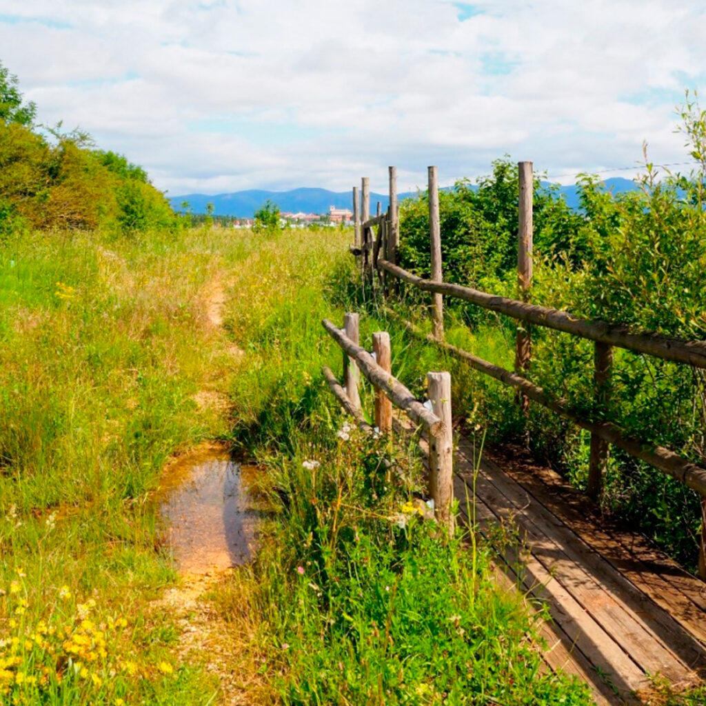
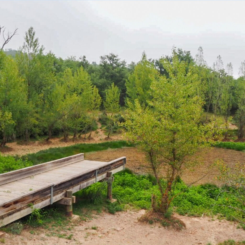
Pedroko Wetland
Just a stone’s throw away from the well-known Sorginetxe dolmen in Arrizala, in fertile lands of the Alavese Plains, lies Pedroko Wetland, a small animal oasis.
Over the last few years, this small wetland has been restored, as it is an important shelter and resting place for birds. An observatory has also been installed as well as a number of walkways atop the water.
Details of Interest
Type of resource: Wetland
Hours: always open
Guided tour: NA
More information
Alavese Plains Tourism Office
Calle Mayor, 8 – 01200 Agurain/Salvatierra
Tel.: 0034 945 30 29 31
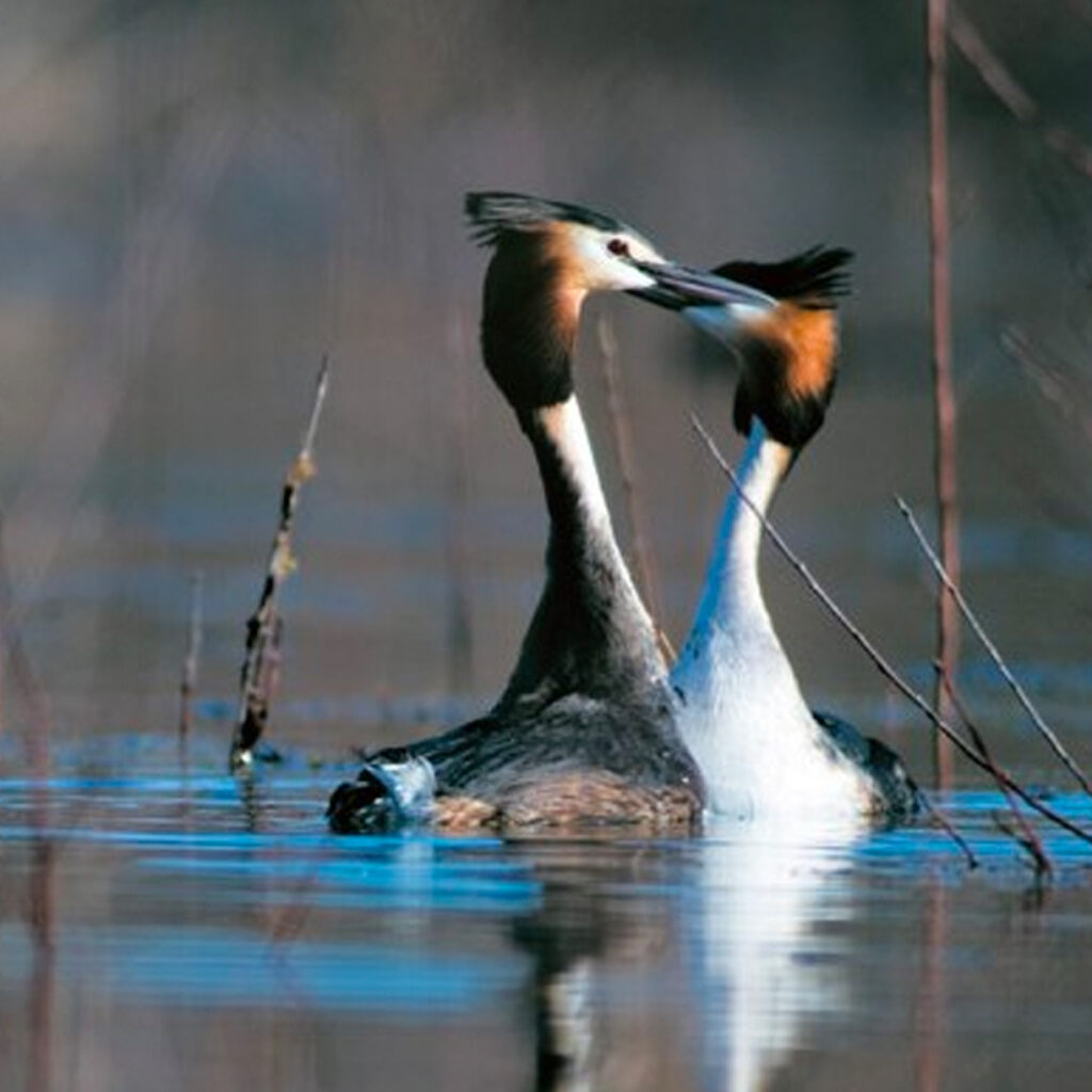
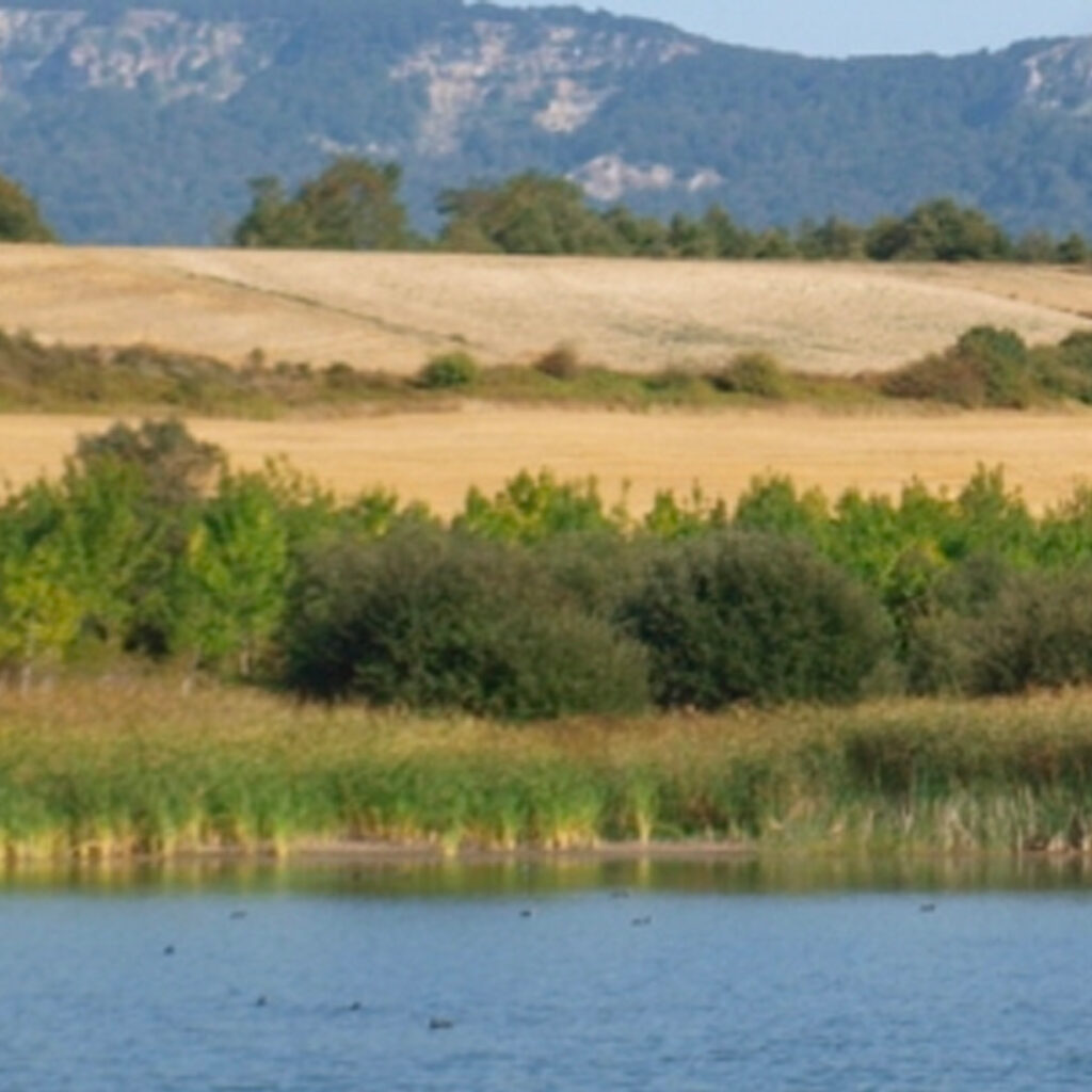
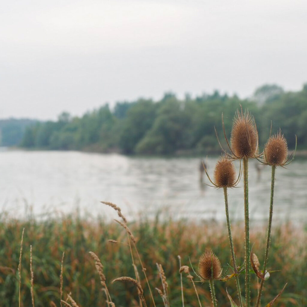
Mendixur Birding Park
On the banks of the Ullíbarri-Gamboa reservoir, lies Mendixur Birding Park, a strategic birdwatching site, where you’ll find a variety of species inhabit the wetland year-round.
The more than 70 hectare Birding Park is on the southern edge of the reservoir and was declared a Wetland of International Importance in the Ramsar Convention. It is also part of the Natura 2000 Network (special area of conservation – SAC – Zadorra System Reservoirs SAC), reaffirming the significant contribution to maintaining its biodiversity and interest in preserving it.
While birds are the main draw to Mendixur and its most visible feature, they are also indicators of the thriving health of the aquatic and land ecosystems sustaining them. The abundance and variety of species found in the park over the course of the year make this area an especially privileged one, well worth discovering, enjoying and taking care of. Respect for all of the beings living here is a commitment all visitors must make.
Remember this is a sensitive space:
– Do not break the peace and quiet with loud noises, music, etc.
– Stay on the path
– Keep your dog on a lead
– Do not take any natural elements with you
– No picnics, parking outside of car parks, fires, littering, fishing, hunting, camping, or spending the night.
Biributxi and Errekabarri paths are equipped with informational panels on the surrounding environment. They also give visitors the chance to walk along the banks of the reservoir and enjoy the wetland’s flora while also leading them to bird hides.
Details of Interest
Type of resource: Bird hide, paths
Hours: the park is always open.
Guided tour: NA.
More information
Garaio Information Office
Garaio Auzoa, 1. 01206
Tel.: 0034 695 782 498
https://ullibarri-gamboa.araba.eus/
Downloads
Atxarte Pond
Just outside the centre of Heredia, following the Royal Post Route, you’ll find the Atxarte pond, a small artificial wetland created for livestock use.
Recent studies have revealed the extensive variety of fauna living in this reservoir, comparable to other natural parks in Euskadi. This led to restoration efforts and improvements to the area, as well as outfitting for visitors.
Details of Interest
Type of resource: Pond, bird hide
Hours: always open
Guided tour: NA
More information
Alavese Plains Tourism Office
Calle Mayor, 8 – 01200 Agurain/Salvatierra
Tel.: 0034 945 30 29 31
Langarika Pond
This small water irrigation pond located next to Langarika has become a space known for its natural beauty and ecological significance as it is a place where birds take refuge, stay and build nests.
A pedestrian trail and a bird hide were installed to allow people to visit the pond without disturbing the wildlife.
Details of Interest
Type of resource: Pond, bird hide.
Hours: always open.
Guided tour: NA.
More information
Alavese Plains Tourism Office
Calle Mayor, 8 – 01200 Agurain/Salvatierra
Tel.: 0034 945 30 29 31
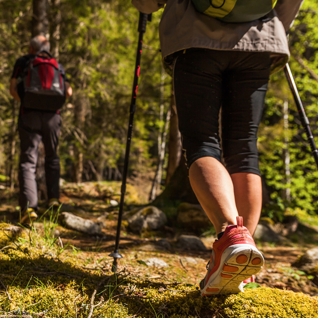
HIKING ROUTES
Download the new walking routes map
You can now download the route map of the Llanada Alavesa.
Discover our Cuadrilla on foot, in the mountains or through ancient oak trees. In the Llanada there are routes for everyone: simple, demanding, long, short…
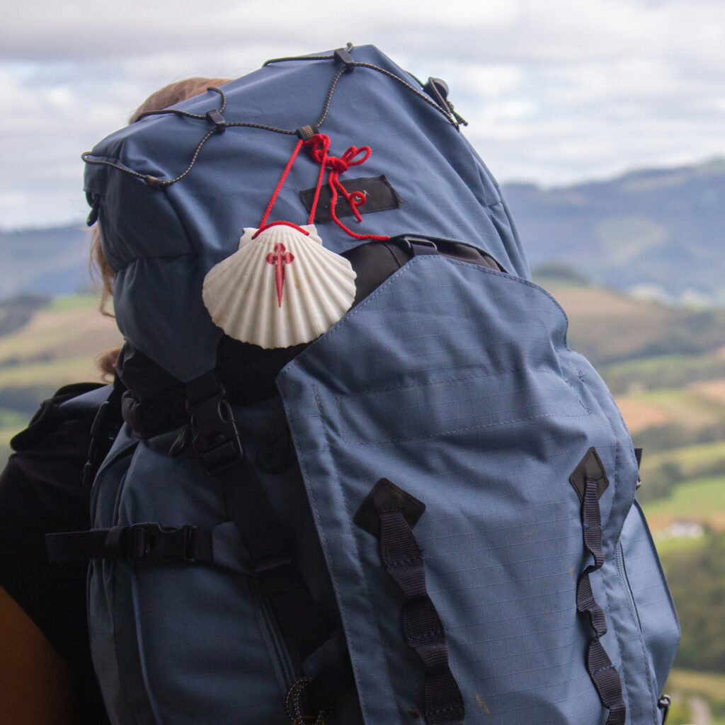
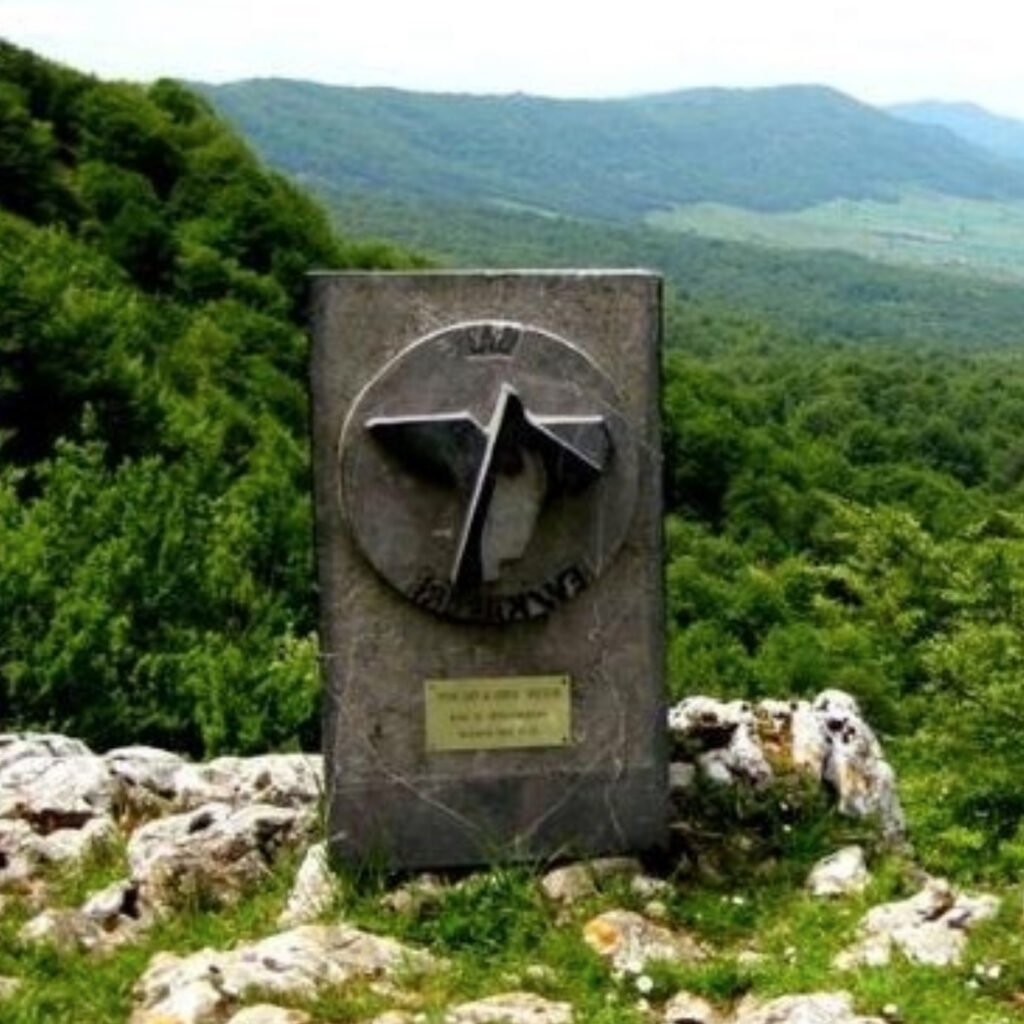
Way of St. James
The Basque Interior Way of St. James crosses the Aizkorri-Aratz mountains, coming from Gipuzkoa via the San Adrián Tunnel and running through Álava from north to south on its journey toward the French Way.
Given its security, the Alavese section was an important connection point for pilgrims, travellers and merchants.
In the early 13th century, it therefore saw a huge uptick in popularity until the 19th century when this popularity began to wane. The route allows hikers to see the components and remains of its golden age and provides the opportunity to see Álava in a new light, full of contrasts and nuances, with historic towns and unique character.
This route goes through mountains and places bursting with history. It runs alongside Megalithic monuments, allows hikers to discover Alavese Romanesque gems, enjoy natural treasures and enchanting landscapes as well as walk along centuries-old vineyards. Naturally, it also gives hikers the opportunity to enjoy the area’s renowned cuisine and cultural activities.
The route begins at the historic San Adrián tunnel, a settlement from time immemorial; it heads into the area of Salvatierra and follows a section of the ancient Roman road Iter XXXIV, the towns of Zalduondo, Ordoñana, Salvatierra, Gazeo, Ezkerekotxa and Elburgo before arriving in the city of Vitoria-Gasteiz.
4th Stage: Zegama – Agurain/Salvatierra
Distance: 22 km
Starts: Zegama
Ends: Agurain/Salvatierra
Cumulative elevation gain: 895 m
Approximate duration: 6h
Say goodbye to Gipuzkoa and hello to Álava. Both territories will show you their finest. There are few borders more beautiful than the San Adrián tunnel, a grotto opened in the rock by water and the passage of time. Over the course of nearly 10 centuries, it was a place visited by merchants and travellers coming and going into and out of Castille. It is currently visited by hikers climbing to the summit of Aizkorri or walkers headed to the Alavese Plains. Once you’ve gone through and seen the sculptural Medieval road, you’ll arrive in another scenic world. The Alavese Plains are nothing like the curvy valleys of Gipuzkoa. Here, the terrain is tame, dry land crops abound and sleepy towns lay at their edges, with splashes of Baroque and Renaissance mansions thrown in.
There is a pilgrims’ shelter in Agurain/Salvatierra.
5th stage: Agurain/Salvatierra – Vitoria-Gasteiz
Distance: 27.4 km
Starts: Agurain/Salvatierra
Ends: Vitoria-Gasteiz
Cumulative elevation gain: 97 m
Approximate duration: 6h
Walkers can breathe easy: the Alavese riverbed stretches on for 50 kilometres, over nearly totally flat terrain. With no hills or mountains, the journey to Vitoria-Gasteiz is a pleasant stroll passing through very few towns. It offers a bit of solitude and a number of religious monuments imbued with magic.
This corner of the Basque Country is more akin to the fields of Castille. It’s also one of the most artistically versatile areas: the plains have prehistoric remnants like dolmens – the Sorginetxe dolmen is one of the most fascinating in the Basque Country – Roman relics like the ones in Arcaya, Medieval remains like the Sanctuary of Our Lady of Estíbaliz, and Renaissance artefacts like the mansions of Salvatierra.
There is a pilgrims’ shelter in Alegría-Dulantzi. There is also a pilgrims’ shelter in Vitoria-Gasteiz.
More information
Alavese Plains Tourism Office
Calle Mayor, 8 – 01200 Agurain/Salvatierra
Tel.: 0034 945 30 29 31
Downloads
Ignatian Way - GR 120
The Ignatian Way recreates the route that Ignatius of Loyola followed in 1522 from his birthplace, Azpeitia (Gipuzkoa) to the Catalan city of Manresa. The pilgrimage began after his spiritual conversion in Loyola and ends in the holy city of Jerusalem.
The way was drawn based on the saint’s personal notes. It begins at the home where Ignatius was born in Loyola (Azpeitia) and leads to the “Cave of Saint Ignatius” in Manresa (near the Montserrat Monastery in Catalonia). It is a long and challenging trek.
4th Stage: Araia – Alda
Distance: 21.3 km
Starts: Araia
Ends: Alda
Cumulative elevation gain: 630 m
Approximate duration: 6h20m
This stage is done entirely in Álava. After leaving Araia, head toward Albéniz and then toward San Román de San Millán, along the ancient Roman road Iter XXXIV from Bordeaux to Astorga and now the N-1 highway. After climbing up to the gate, the trail follows an impressive cliff with unbeatable views of the clearings of Zezama and then flattens out until Opakua pass. When you begin to lose elevation near the Arana Valley, you’re nearing the end of the stage. All you need to do is pass Ullíbarri-Arana and then follow the track to reach the day’s end point, Alda.
More information
Alavese Plains Tourism Office
Calle Mayor, 8 – 01200 Agurain/Salvatierra
Tel.: 0034 945 30 29 31
Downloads
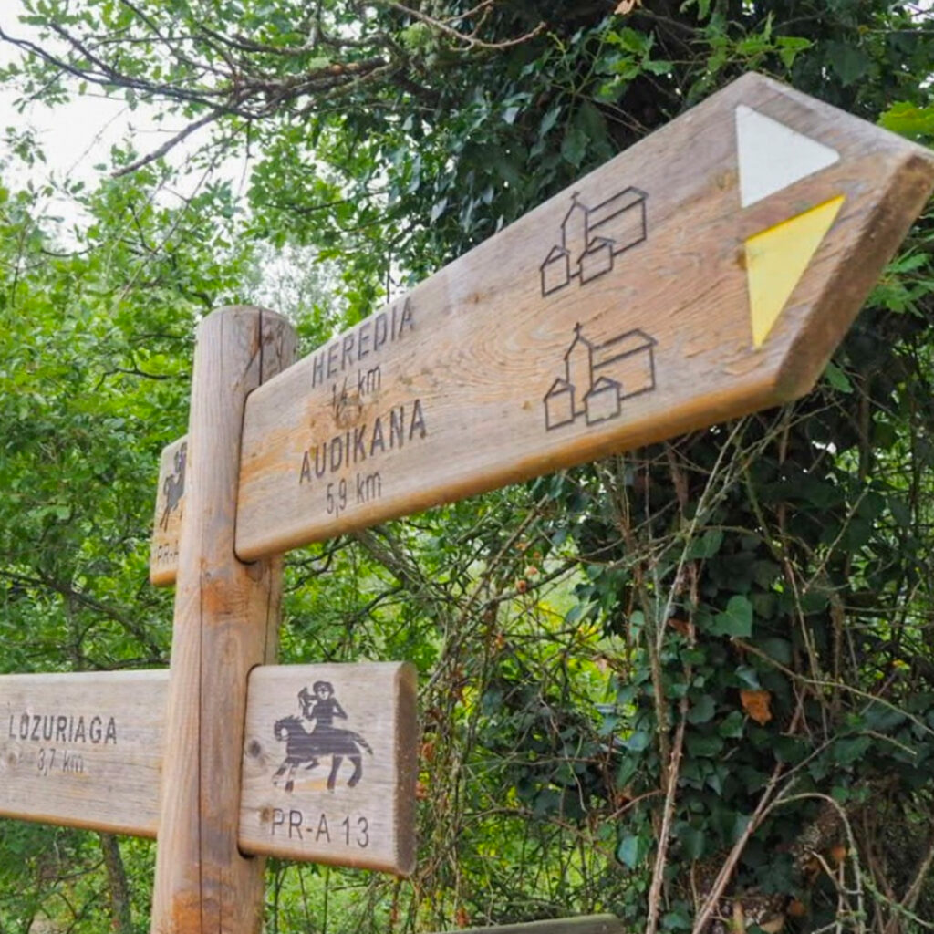
PR-A-13 Royal Post Route
The Royal Post Route was used by the mail service to carry the post into France in the 15th, 16th and 17th centuries.
This long-standing route is now an alternative to the Way of St. James to reach the Capital of Álava from San Adrián allowing visitors to see a variety of components that have born witness to the passage of time.
The short PR-A 13 trail starts in the Mandobide car park in Zalduondo. While it coincides with the Way of St. James and GR-25, it soon leaves them behind as it travels deep into the heart of the Alavese Plains. On the way to the hermitage of San Martín de Ania, the trail passes through the small towns of Galarreta, Luzuriaga, Heredia and Audikana and passes by components of the old trail like the cross of Berokia and the Zubibarri bridge.
We cannot fail to mention the lushness of the nature surrounding the trail, as it passes through the mountains of Aldaia and flows along the edge of the Ullíbarri Gamboa reservoir (Ramsar wetland). Before it ends, the trail crosses paths with the GR 38 Wine and Fish route, at the Mariturri spring.
Distance: 29 km
Starts: Mandobide
Ends: Ania
Cumulative elevation gain: 300 m
Approximate duration: 7h15m
More information
Alavese Plains Tourism Office
Calle Mayor, 8 – 01200 Agurain/Salvatierra
Tel.: 0034 945 30 29 31
Downloads
GR 25 Around the plains at the foot of mountains
GR 25 goes around the plains at the foot of mountains. It’s a trail without much elevation gain that circles the Alavese Plains on the old routes separating the fields from the beech and oak forests of the surrounding mountains.
Beginning in Olarizu, on the green way of Vitoria-Gasteiz, head east following the base of the Mountains of Vitoria. When you reach Opakua, at the foot of the Entzia mountain range, turn north toward Araia and the entrance to Aizkorri Aratz Natural Park. From there, follow the westward path toward Landa Provincial Park, under the gaze of the Elgea Mountains. Once you’ve passed Legutio just outside Gorbea Natural Park, the path will veer south toward Nanclares de la Oca and finally circle back to meadows of Olarizu.
Stage 1: Olarizu – Adana
Distance: 22.8 km
Starts: Olarizu
Ends: Adana
Cumulative elevation gain: 73 m
Approximate duration: 6h15m
GR 25 goes around the plains and begins near the centre of Mendiola. You will pass Monasterioguren, Ullíbarri de los Olleros and Egileta to arrive at Gauna where the trail coincides with the old Basque-Navarre Railway. Before reaching Ullíbarri-Jauregi, you’ll leave behind this old railway turned green way to reach the end of the stage in Adana.
– GPX Olarizu – Adana
Stage 2: Adana – San Román de San Millán/Durruma
Distance: 24.7 km
Starts: Adana
Ends: San Román de San Millán/Durruma
Cumulative elevation gain: 874 m
Approximate duration: 8h15m
The old Basque-Navarre railway can be found to the south of Adana. You’ll follow it to Ullíbarri-Jauregi. The GR 25 continues eastward as passes through Egileor and Alangua, reaching Opakua at the foot of the Entzia mountains. To get to the end of the stage in San Román de San Millán, you’ll walk through the centuries-old oak forests at the foot of the springs of the Zadorra.
– GPX Adana – San Millán
Stage 3: San Román de San Millán/Durruma – Zalduondo
Distance: 20 km
Starts: San Román de San Millán/Durruma
Ends: Zalduondo
Cumulative elevation gain: 587 m
Approximate duration: 6h15m
Below the vertiginous Entzia mountain range, you’ll walk through a forest of gall oaks toward Urabain and then head toward La Leze park. Once you’ve walked by the cave, GR 25 heads west through Aizkorri-Aratz Natural Park to the beautiful source of the Zirauntza river. At the end of the stage, you’ll find the Medieval town of Zalduondo, where the majestic stately homes and mansions will welcome you to rest
– GPX Durruma – Zalduondo
Stage 4: Zalduondo – Barria
Distance: 12.8 km
Starts: Zalduondo
Ends: Barria
Cumulative elevation gain: 195 km
Approximate duration: 3h40m
Starting in the Medieval village of Zalduondo, a milestone on the old path connecting Álava and Gipuzkoa via the San Adrián tunnel, you’ll head west and arrive at the old Barria monastery, which is now a youth hostel.
– GPX Durruma – Zalduondo
More information
Alavese Plains Tourism Office
Calle Mayor, 8 – 01200 Agurain/Salvatierra
Tel.: 0034 945 30 29 31
Downloads
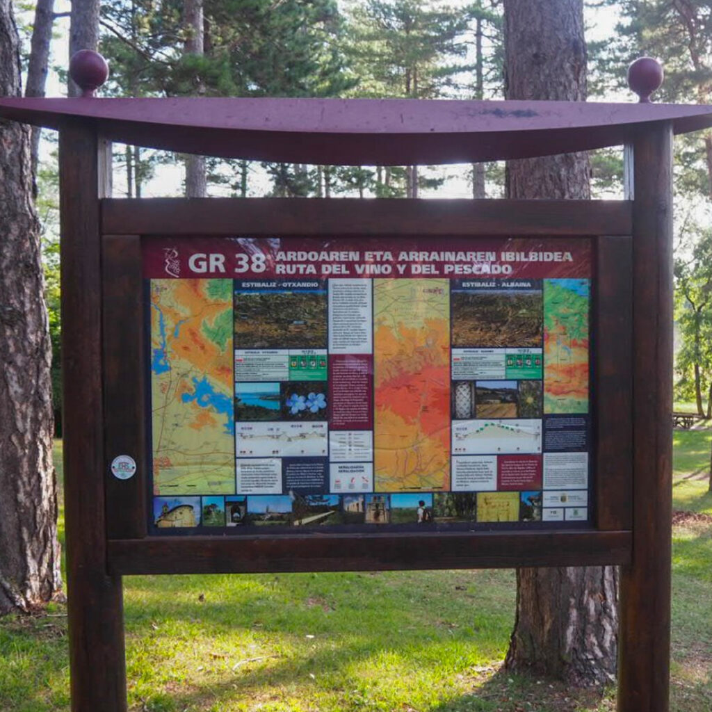
GR 38 Wine and Fish Route
Grand Route GR 38 doesn’t just happen to be named the Wine and Fish Route; for centuries mule drivers walked its paths taking Rioja Alavesa wine north and bringing back brined fish from the ports of Bizkaia.
In Álava the GR divides Oyón from north to south and passes through some spectacular spots, including the Toloño Mountains, the Ayuda river gorge, the rock churches of Treviño, the tall mountains of Vitoria and the Ullíbarri-Gamboa reservoir.
Stage 4: Estíbaliz – Legutio
Distance: 27.3 km
Starts: Estíbaliz
Ends: Legutio
Cumulative elevation gain: 563m gain, 605m loss
Approximate duration: 6h15m
This trail connects Estíbaliz Sanctuary with the town of Legutio via the contrasting landscape of the Alavese Plains.
This is the toughest stage of the GR 38. It is nearly 28 km long and connects the monastery of Estíbaliz with Legutio. You’ll walk the trails of the Alavese Plains while enjoying the beauty of the scenery and the contrasts of its reservoirs.
– GPX Estíbaliz – Legutio
More information
Alavese Plains Tourism Office
Calle Mayor, 8 – 01200 Agurain/Salvatierra
Tel.: 0034 945 30 29 31
GR 282 Shepherds’ Path
The Shepherds’ Path is an invitation to learn about and treasure the ancient practice of shepherding, to not let slip away the knowledge and experience accumulated over generations of people who have respected and conserved their environment, shaping the one we know today.
On the path, you’ll find joyful, talkative people, their stories, experiences and legends, helping you understand and better cherish the natural bounty of your surroundings. Many indigenous species, gems adapted to the nature around you like Latxa sheep, Navarre mares, Azpi Gorri goats, Terreña cows, Pirenaica cows, Losino or Basque Mountain horses will accompany you on your journey while shepherds’ gazes watch over them.
Stage 13: San Vicente de Arana – Urbasa
Distance: 32.58 km
Starts: San Vicente de Arana
Ends: Urbasa
Cumulative elevation gain: 1370 m
Approximate duration: 10h55m
Cross Entzia and the Iturrieta mountains, a small vertiginous range jutting out above the Alavese Plains, housing at its feet small livestock farming communities like Valle de Arana, where you’ll begin to follow the mountain range through Opakua, with the Urbasa mountains running alongside, through magical forests that open onto ancient clearings where livestock still grazes.
– GPX
More information
Alavese Plains Tourism Office
Calle Mayor, 8 – 01200 Agurain/Salvatierra
Tel.: 0034 945 30 29 31
Green routes through the centuries-old oak forests and springs of the Zadorra
Centuries-old oak forests and springs of the Zadorra (Munain – Okariz)
Distance: 11.1 m
Starts and ends: Munain
Cumulative elevation gain: 360 m
Approximate duration: 2h45m
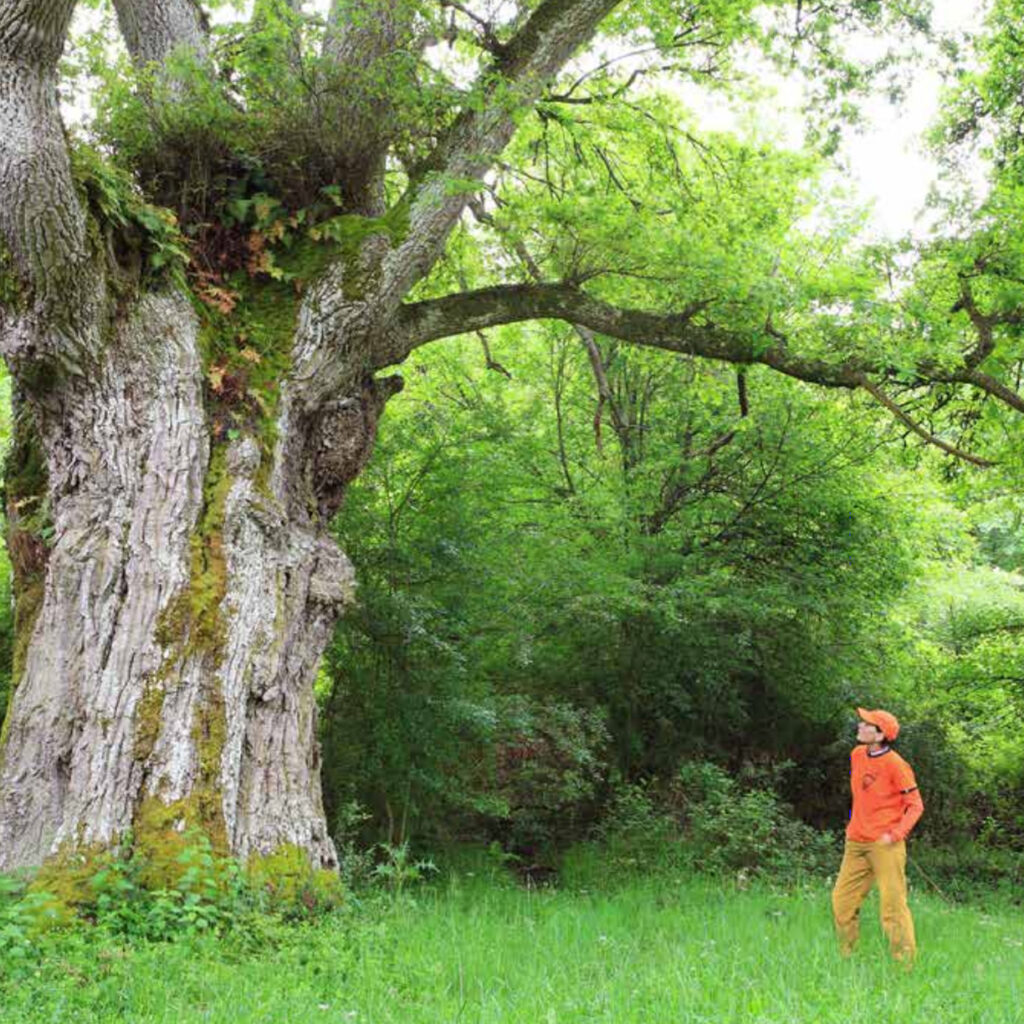
This green route takes you to the centuries-old oak forests of Munain and Okariz. This magnificent setting is inhabited by over 500 trees that are more than 500 years old with some of them a whopping 1,500 years old.
The main use of the forests on these mountains was once logging. They would cut off the branches, so the trees have acquired a candlestick-like shape characteristic of pollarded trees. This is the origin of the Basque name for the forest reserves in this area, Arimotx, meaning pollarded oak. Livestock also grazed this area, giving the area a pasture-like feel. Sheep ate the grass and pigs ate the chestnuts in the fall.
The route delves further into the forest to a small spring, the source of the Zadorra river.
– Brochure and Map in French and English
– GPX Centuries-old oak forests
– GPX Springs of the Zadorra
Centuries-old oak forests of Galarreta and Zalduondo
Distance: 6.2km (Galarreta), 5.2km (Zalduondo)
Starts and ends: San Pablo car park (Galarreta) / Malpaso car park (Zalduondo)
Cumulative elevation gain: 300 m
Approximate duration: 2h (Galarreta), 1h40m (Zalduondo)
The majority of the large oaks between Galarreta and Zalduondo are pollarded sessile oaks (Quercus petraea), trees that have been pruned to disproportionately thicken their trunks. The trees were pollarded to extract coal and allow livestock to graze beneath them.
It was thus a wooded pasture, i.e., a space where livestock farming and forestry coincided.
There are two particularly notable trees here.
They are the ‘Grandfather of Galarreta’ (San Millán), more than 8 m around, and the ‘Beorlatza Oak’ (Zalduondo), a hybrid more than 7.5 m around.
The former is said to be the widest oak in all of the Basque Country. The
latter is said to have space in its trunk for a dozen people.
– GPX Galarreta
– GPX Zalduondo
More information
Alavese Plains Tourism Office
Calle Mayor, 8 – 01200 Agurain/Salvatierra
Tel.: 0034 945 30 29 31
Ullibarri Gamboa Reservoir Routes
Full reservoir loop
Distance: 43.6 km
Starts and ends: Garaio Provincial Park Information Centre
Cumulative elevation gain: 100 m
Approximate duration: 9h30m walking, 5h cycling
Following the perimeter of the Ullíbarri-Gamboa reservoir, this trail will take you to Mendixur Birding Park and the interior beaches of Álava in Landa and Garaio Provincial Parks.
– GPX
Northern Reservoir Route
Distance: 31.8 km
Starts and ends: Landa
Cumulative elevation gain: 75 m
Approximate duration: 7h30m walking, 3h30m cycling
The Northern Reservoir Route is a circular, 32 km-long route beginning in Landa Provincial Park. It runs around Ullíbarri-Gamboa reservoir and uses the Azúa footbridge as a shortcut. It is a lovely bike ride, but you should plan well if you’d prefer to walk, as it can take more than seven hours to complete.
– GPX
Southern Route: Loop Around the Wetland at the Edge of the Reservoir
Distance: 12.8 km
Starts and ends: Garaio Provincial Park Information Centre
Cumulative elevation gain: 25 m
Approximate duration: 2h30m walking, 1h30m cycling
This route will take you to the banks of the Ullíbarri-Gamboa reservoir, including the Ramsar Convention Wetlands and Mendixur Birding Park, where a large number of migratory birds come every year.
– GPX
More information
Alavese Plains Tourism Office
Calle Mayor, 8 – 01200 Agurain/Salvatierra
Tel.: 0034 945 30 29 31
Mendixur Trails
The banks of the Ullíbarri-Gamboa reservoir are included on the list of Wetlands of International Importance set out in the RAMSAR Convention and are part of the Natura 2000 Network.
Mendixur Birding Park is located in this protected environment and offers the possibility to watch the various bird species that inhabit it year-round.
Two of the paths will take you to the park’s lookout points: Biributxi, with access to the Los Buceadores and Los Carboneros observatories, and Errekabarri, which leads to the old open-air Los Trogloditas observatory. These features will allow you to walk up to the banks of the reservoir and enjoy the plant life and large number of bird species inhabiting the wetland.
Errekabarri Trail
Distance: 600 m
Starts and ends: Mendixur car park
Approximate duration: 10 minutes
Errekabarri path is approximately 600 m long. The path to the right leads to Carboneros observatory and the left-hand path leads to Trogloditas observatory.
– GPX
Biributxi Trail
Distance: 1 km
Starts and ends: Mendixur car park
Approximate duration: 15 minutes
Biributxi, which is only slightly longer than 1000 m, leads to the Buceadores observatory.
– GPX
More information
Garaio Information Office
Garaio Auzoa, 1. 01206
Tel.: 0034 695 78 24 98
https://ullibarri-gamboa.araba.eus/
Downloads
SL-A-14 Source of the Zirauntza
An easy and beautiful stroll that will take you out into nature through beech and oak forests, alongside the Zirauntza river.
Well-marked throughout, the route is labelled with signage reading SL-A 3006 (previously SL-A 14) and white and green markings.
The river flows through Aizkorri-Aratz Natural Park, where you’ll find botanical diversity and an extraordinary patchwork of flora comprising Pyrenean oaks (Quercus pyrenaica), Portuguese oaks (Quercus faginea), European beeches (Fagus sylvatica) and European oaks (Quercus robur) providing shelter to abundant and varied fauna: in addition to wild boar (Sus scrofa), European hare (Lepus europaeus) and roe deer (Capreolus capreolus), there are also species more difficult to come across like beech marten (Martes foina), European pine marten (Martes martes), European badger (Meles meles) and wildcat (Felis silvestris).
The route can be done any time of year, although spring and fall are best for enjoying the landscape’s colourful nuances.
Distance: 3.8 km
Cumulative elevation gain: 308m gain, 232m loss
Starts and ends: Aizkorri-Aratz Visitors’ Centre
Approximate duration: 1h20m
More information
Aizkorri-Aratz Visitors’ Centre
Intuxi Kalea, 48 – Araia
Tel: 0034 945 38 69 64 – 0034 688 629 932

Tobería Falls Route
This 1.5 km route starts in Andoin and leads to the beautiful Tobería Falls, a remarkably beautiful set of waterfalls.
The route begins from the plaza in Andoin. Set foot by following a street that later turns into a concrete path leading to an old mill on the right-hand side of the river. Shortly thereafter, cross the small footbridge over the river. In approximately 300 metres, you’ll reach a fork in the road and veer left after going through a metal barrier. Don’t forget to shut it behind you!
Later there is another fork in the trail. Head right and leave the other path to the left, which follows the edge of a livestock enclosure. In about 200 metres, you’ll find another fork in the road. Go left and you’ll need to go through another metal barrier in a few metres. From there, you’ll follow the track surrounded by centuries-old beeches and oaks to the source of the river. There, you’ll find a small water wheel and a catchment. If you cross the river and follow the small trail down the right-hand bank, you’ll reach the source of the river.
If you do this route during the rainy season, you’ll come upon several waterfalls in this last section, some of them quite stunning. Go back the way you came.
Distance: 1.2 km (2.4 km there and back)
Cumulative elevation gain: 132m gain, 7m loss
Starts and ends: Plaza de Andoin (Asparrena)
Approximate duration: 1h20m (there and back)
– GPX
More information
Alavese Plains Tourism Office
Calle Mayor, 8 – 01200 Agurain/Salvatierra
Tel.: 0034 945 30 29 31
Route of the Three Hermitages
The Route of the three hermitages is a circular route that allows us get to know a small sample of the heritage religious architectural area, shows, in turn, the importance of the region as a transit area and of pilgrimage.
The Route of the three hermitages is a circular route that allows us get to know a small sample of the heritage religious architectural area, shows, in turn, the importance of the region as a transit area and of pilgrimage.
Along the route we will find three jewels of the Llanada Alavesa: the hermitage of San Juan de Arrarain (Elburgo), the hermitage of San Pedro de Quilchano (Argómaniz) and the hermitage of Our Lady of Ayala (Alegría-Dulantzi).
Distance: 10,5km
Cumulative elevation gain: 209,
Starts and ends: Several options
Approximate duration: 2h30m
– The route in Wikiloc
More information
Alavese Plains Tourism Office
Calle Mayor, 8 – 01200 Agurain/Salvatierra
Tel.: 0034 945 30 29 31
Egilatz-Araia archeological route
This routes gives you the chance to know our region better, from the megalithic remains to the testimonies of the industrial era. From the mysterious Aizkomendi Dolmen to the imposing Castle Marutegi, passing by the Ajuria and Urigoitia factory.
The Alavese Plains is a region with a fascinating historical past spanning from prehistoric times to the era industrial. This tourist route is an experience enriching to know further our archeology and understand the importance of the industry in our recent past.
This routes gives you the chance to know our region better, from the megalithic remains to the testimonies of the industrial era. From the mysterious Aizkomendi Dolmen to the imposing Castle Marutegi, passing by the Ajuria and Urigoitia factory.
In the Alavese Plains there is a wide range of experiences that will allow you explore and better understand the rich heritage of our region.
Distance: 9,2km
Cumulative elevation gain: 290m
Starts and ends: Aizkomendi dolmen
Approximate duration: 2h55m
– The route in Wikiloc
More information
Alavese Plains Tourism Office
Calle Mayor, 8 – 01200 Agurain/Salvatierra
Tel.: 0034 945 30 29 31

Pedroko wetland - Sorginetxe dolmen
Walking, cycling, observing nature, admire the cultural heritage… Whatever the reason, enjoy walking this route to know the Pedroko wetland and the dolmen of Sorginetxe!
Walking, cycling, observing nature, admire the cultural heritage… Whatever the reason, enjoy walking this route to know the Pedroko wetland and the dolmen of Sorginetxe!
It is an easy and simple marked route, which can be done in both directions. We recommend completing it going up to the Pedroko viewpoint to enjoy the views that the around.
Distance: 3,8-8,4km
Cumulative elevation gain: 30-172m
Starts and ends: Sorginetxe dolmen or Pedroko wetland
Approximate duration: 50m – 2h55m
– The route in Wikiloc
More information
Alavese Plains Tourism Office
Calle Mayor, 8 – 01200 Agurain/Salvatierra
Tel.: 0034 945 30 29 31
Nordic Walking Centres
The Alavese Plains are a Nordic walker’s paradise. There are many routes for different levels as well as information centres throughout the region.
Nordic walking is a resistance sport consisting in walking aided by the thrust of poles.
The Alavese Plains have centres in the following towns:
– Agurain/Salvatierra (Lezao Sports Centre)
– Alegría-Dulantzi (Municipal Sports Centre)
– Araia (Arrazpi Berri Sports Centre)
– Azilu (City Hall)
– Elburgo / Burgelu (Municipal Sports Centre)
– Ordoñana (City Hall)
– Ozaeta (City Hall)
Each centre offers a few common services: pole rentals and routes marked and maintained for the sport. These routes are classified based on fitness level.
Route maps:
– Alegría-Dulantzi – Azilu – Burgelu
The Nordic Walking of Euskadi centre website also has each of these routes on Wikiloc and GPX.
More information
Alavese Plains Tourism Office
Calle Mayor, 8 – 01200 Agurain/Salvatierra
Tel.: 0034 945 30 29 31
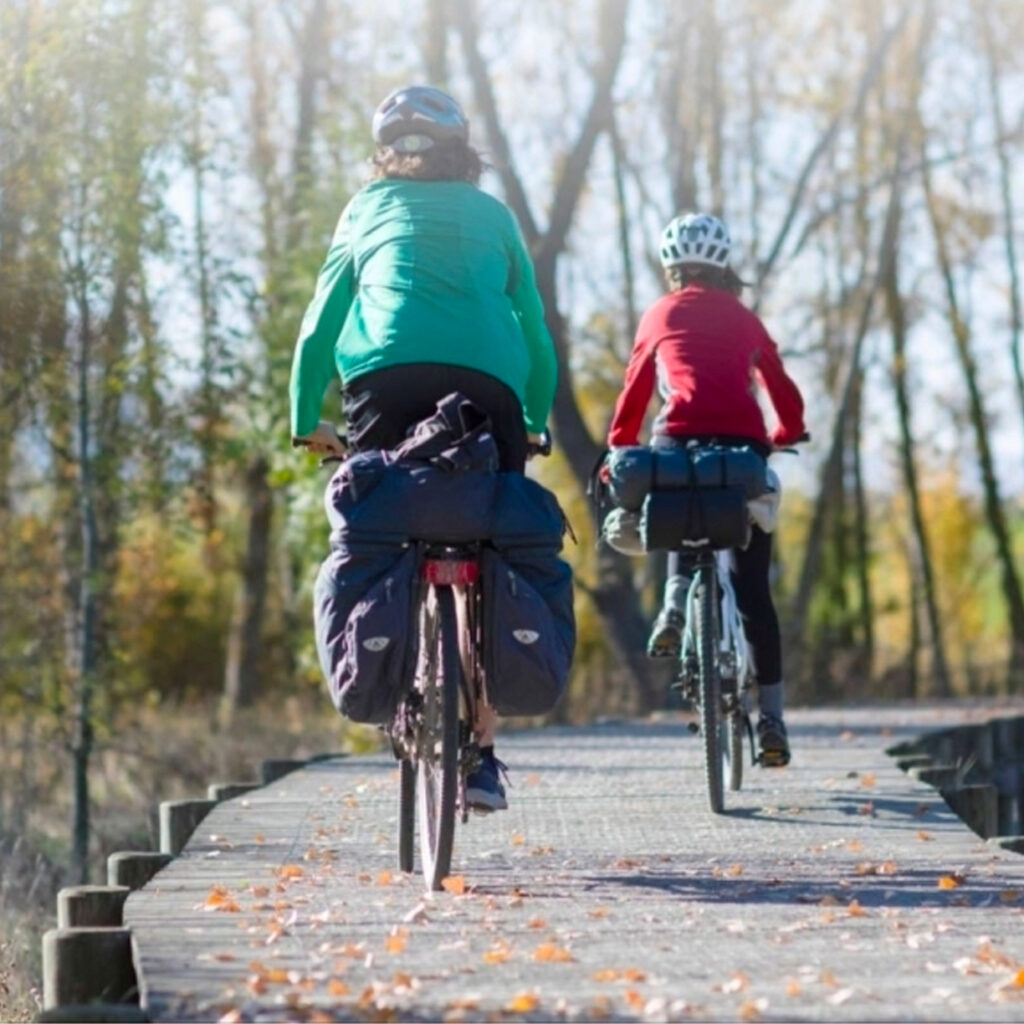
CYCLING TOURISM

Download the Llanada Alavesa cycling tourism map
You can now download the route map of the Llanada Alavesa.
Discover our Cuadrilla by bike, in the mountains or through ancient oak trees. In the Llanada there are routes for everyone: simple, demanding, long, short…
the mountains or through ancient oak trees. In the Llanada there are routes for everyone: simple, demanding, long, short…
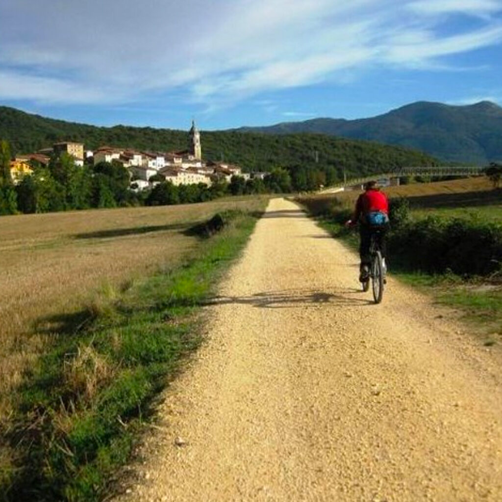
Grand Touring Cyclist Route of the Alavese Plains
A mountain bike, some saddlebags and a desire to have some fun and discover some wonderful corners of the world is all that’s needed to start this adventure beginning and ending at the Ataria Nature Information Centre.
The best way to follow it is clockwise. This causes you to do six small routes: the Basque-Navarre Railway Green Route, the Ullibarri-Gamboa reservoir, the Royal Post Route, the Way of St. James and back to the Basque-Navarre Green Route with the Estíbaliz section.
To fully soak in everything the route has to offer, you should ideally do it over two or three days, dividing the stages up according to your cycling level. The towns along the way (Maturana, Narbaiza, Araia and Agurain-Salvatierra) are perfect stops as they have a number of services and places to stay the night.
Part of the trail is also connected by train, allowing you to quickly and easily go back or get onto the route. The route is designed for all skill levels. Alone, with family or with friends, it is the perfect opportunity to delve into the heart of Álava, a land with infinite possibilities. All you’ve got to do is try it.
Taking a bike ride through Álava is a ride through the history of this land, accompanied by a colourful landscape you’ll never forget.
Distance: 117 km
Starts: Ataria Nature Information Centre (circular route)
Cumulative elevation gain: 815 m
Approximate duration: 2/3 days
Number of stages: can be done in 2 or 6 (see stages)
More information
Alavese Plains Tourism Office
Calle Mayor, 8 – 01200 Agurain/Salvatierra
Tel.: 0034 945 30 29 31
Basque-Navarre Railway Green Route
The Basque-Navarre Railway Green Route is a long and appealing route between Arlabán pass (the border between the provinces of Álava and Gipuzkoa) and Estella, a town on the Way of St. James.
It crosses the entire province of Álava from north to south-east and heads into the Alavese Plains and mountains to Estella in Navarre. It is considered one of the longest in all of Spain. Given its length, the route is divided into different sections: one section through Vitoria-Gasteiz and the other the long, impassable Laminoria tunnel.
In the 19th century, there was political will to build a rail project to unite Bilbao and Vitoria-Gasteiz via Durango with a narrow-gauge railway. Juan José y Joaquín Herrán created the project. It overcame an enormous number of mishaps and was built in two sections; one from Vitoria-Gasteiz to Mekoalde (1919) and the other from Vitoria-Gasteiz to Estella (1927). This line was completed in 1967. The majority of the infrastructure has been dismantled between then and now and it has been refurbished for pedestrian enjoyment. Distance: 29 km
The path has three sections. The second is the one that crosses the western part of the Alavese Plains. This portion of the Basque-Navarre Railway Green Route offers the possibility of visiting the Our Lady of Estíbaliz Sanctuary, a great viewpoint of the region.
Stage 2: Vitoria – Laminoria Tunnel
Distance: 19.3 km
Starts: Vitoria-Gasteiz.
Ends: Laminoria Tunnel.
Cumulative elevation gain: 338m gain, 135m loss.
Approximate duration: 4h walking, 2h cycling.
More information
Alavese Plains Tourism Office
Calle Mayor, 8 – 01200 Agurain/Salvatierra
Tel.: 0034 945 30 29 31
Downloads

Pedroko wetland - Sorginetxe dolmen
Walking, cycling, observing nature, admire the cultural heritage… Whatever the reason, enjoy walking this route to know the Pedroko wetland and the dolmen of Sorginetxe!
Walking, cycling, observing nature, admire the cultural heritage… Whatever the reason, enjoy walking this route to know the Pedroko wetland and the dolmen of Sorginetxe!
It is an easy and simple marked route, which can be done in both directions. We recommend completing it going up to the Pedroko viewpoint to enjoy the views that the around.
Distance: 3,8-8,4km
Cumulative elevation gain: 30-172m
Starts and ends: Sorginetxe dolmen or Pedroko wetland
Approximate duration: 50m – 2h55m
– The route in Wikiloc
More information
Alavese Plains Tourism Office
Calle Mayor, 8 – 01200 Agurain/Salvatierra
Tel.: 0034 945 30 29 31
ADVENTURE
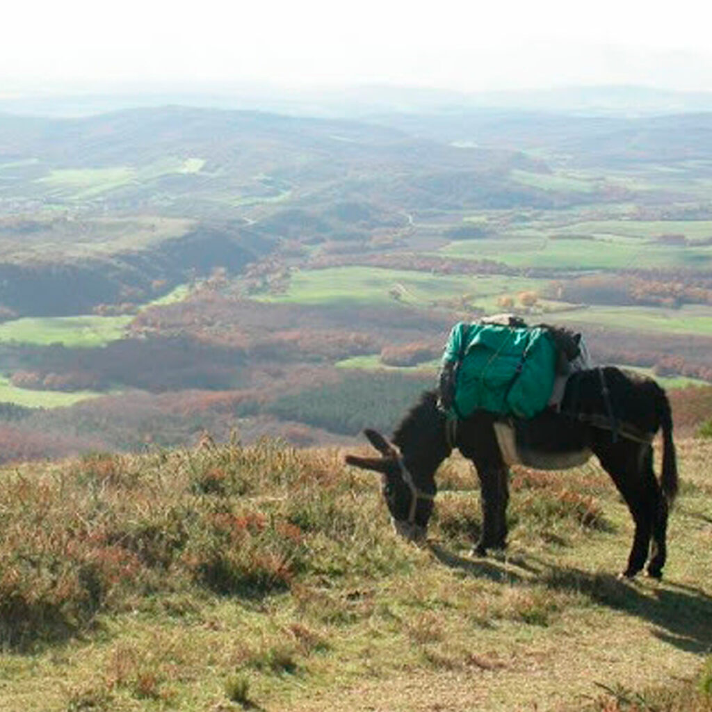
Burros Trekking - Asnería Saroizar
The Asneria Saroizar trail offers visitors the chance to walk the old paths of the area on foot, accompanied by one or more donkeys to help transport packs and loads. Children under 40 kg can also ride them for short periods of time.
The donkeys are trained to follow the marked path. It’s an unforgettable experience for kids and grown-ups alike.
The routes can last anywhere from ½ a day to 7 days. You can follow one of our routes or choose the one you like best. Most of the trails are marked as official Great Routes or Short Routes. We also provide a 1:25000 scale map of the area with the route being followed and a corresponding track to be put into a GPS.
Contact
Saroizar s/n. Narbaiza 01208 (San Millán-Donemiliaga)
Tel.: 0034 609 228 095
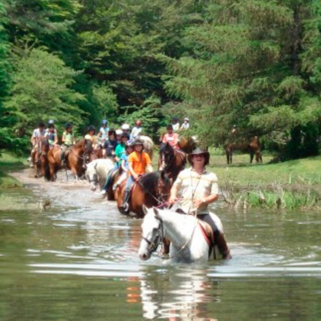
Caballerizas Bikuña
Caballerizas Bikuña provides the perfect facilities and an exceptional environment for horseback riding. They offer riding excursions and routes into nature.
Caballerizas Bikuña is a family business working in the world of horses for more than 20 years. Over the course of this time, we’ve built our own herd, the Yeguada Calatañazor, comprised of the best lines of Arabian Purebreds (PRA) and Spanish Purebreds (PRE). We have over 50 horses in total including PRA, PRE and crossbreeds.
Caballerizas Bikuña is located in the small town of Bikuña (Álava), located in the Alavese Plains, between the Entzia, Urbasa and Urbía mountains. Pure nature. This incredibly special environment makes our horseback riding experiences highly gratifying and unforgettable.
If you love horses, come visit us and learn about our activities. Riding tourism, endurance riding, lessons for beginners and advanced riders and children’s camps are just some of them.
Contact
Arbe Kalea, 9, 01207 Bikuña (San Millán-Donemiliaga)
0034 945 31 22 89
0034 617 053 998
contacto@caballerizasbikuna.com
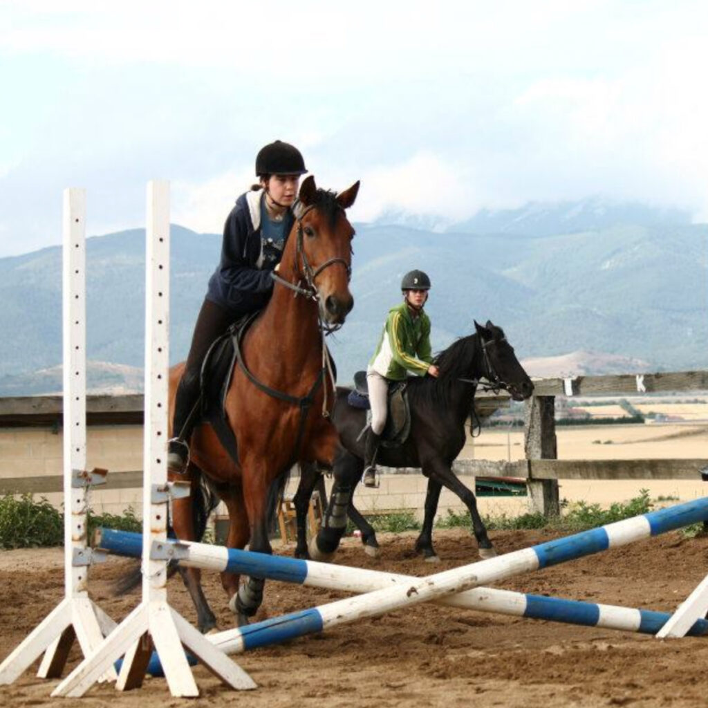
Hípica Agurain
Hípica Agurain an equestrianism centre located in Salvatierra-Agurain. Just 20 minutes from Vitoria-Gasteiz, in the middle of the Alavese Plains.
It provides wonderful facilities and an unparalleled environment for horseback riding. With more than 10 years of experience in the industry, it offers safe, amiable, professional services to enjoy this sport in the great outdoors.
Hípica AGURAIN is in Salvatierra/Agurain. It is a company solely dedicated to horseback riding. And if you don’t have a horse, the company will loan you one of its own for beginners’ classes so you can enjoy riding in one of the most emblematic places in Álava.
Hípica Agurain can also prepare you for advanced Gallop levels approved by the EC. You’ll also be able to take the I Estrella, II Estrella, and Poni de Bronce exams. Services and activities include boarding, farrier, training, riding and breaking-in.
Hípica Agurain provides everything you need to go on a horseback excursion. It also has outdoor and indoor tracks, stalls… Its guided tours last about one hour and are offered year-round. Activities for small children, professionals, and amateurs.
Contact
C/ de Magdalena nº 21, 01200 Agurain/Salvatierra
0034 696 328 412
0034 664 294 207
hípica.agurain@gmail.com
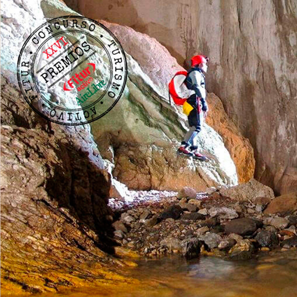
Inguru Abentura (Albeniz)
If you’ve got the spirit of adventure and are looking to explore one-of-a-kind places where few people dare to venture, join us and we’ll guide you on an exciting adventure through the Earth’s most hidden treasures.
We organise all kinds of outdoor teambuilding activities to get the best out of your team. Trust, communication, teamwork… A fun and effective tool! We’ve got a wide variety of activities in nature and lessons adapted to the environment where students will have fun as they learn.
Here are some of the activities you can enjoy in the Alavese Plains:
SPELEOLOGY· CANYONING INTO LA LEZE (Active Tourism Award, Fitur 2021) · ADVENTURE SPORTS· ROCK-CLIMBING· HIKING · ORIENTEERING
- Included in the Euskadi Code of Ethics Register
Contact
0034 635 748 948
info@inguruabentura.com
Lautada Puzle Room
Lautada Puzle Room is the Alavese Plains’ first escape room. Use your skills to solve a series of puzzles and get out before time runs out!
An escape room is a game where you need to use your skills and work as a team to solve a series of puzzles and get out of the room before time runs out. 2 to 5 participants, ages 7 and up. Minors must always be accompanied by an adult.
The game: life in the 23rd century is very different to the way we live today. Self-involved, proud and relentless human activity has led the Earth to the verge of total destruction. Climate change has caused a number of natural disasters putting the survival of the species and the planet in danger. Will you be able to turn this situation around and recover a way of life that respects our environment? Will you be able to save the planet?
c/ Goitialde, 3 – 01206 Audikana (Barrundia)
0034 699 544 088
puzleroom@ salaescapelautada.com
Product clubs: Family Tourism
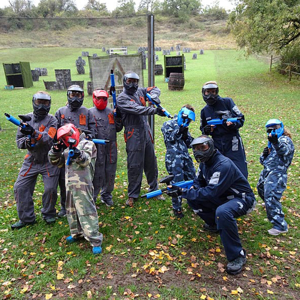
Paintball Iturgutxi
Enjoy paintball with Paintball Iturgutxi. There are 6 playing fields: the forest, the wild west, the camp site, the containers, the junkyard and the scrapyard. For adults and kids 7 to 11. Groups of 8 to 60 people. No time limit!
Goiko Auzoa, s/n – 01208 Galarreta
0034 671 580 011
info@paintball-iturgutxi.com
Product clubs: Code of Ethics of Euskadi
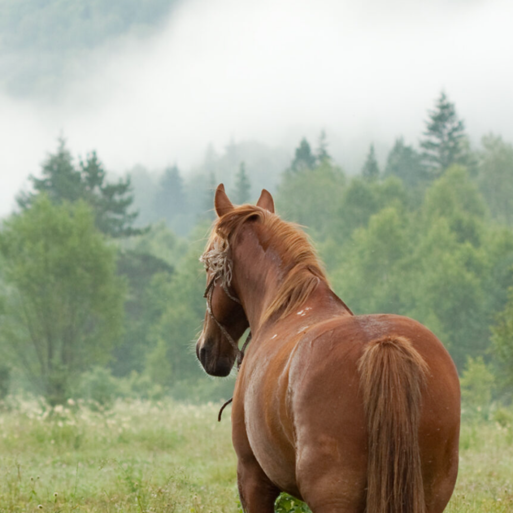
Mendibil Tours
Discover Álava’s Barrundia Valley with a special horseback riding tour. See the landscapes, traditions and history of the Alavese Plains in a way you’d never imagine.
Our horseback riding tour through the Alavese Plains is unforgettable.
Discovering the beautiful landscapes of the Barrundia Valley on horseback is no everyday experience. The route begins in Ozaeta and passes through forests, clearings, streams and villages. We’ll stop at key points with beautiful views to rest, take pictures and have a snack.
The route is circular, so we finish right back in Ozaeta. We’ll tell you all about the traditions, history and culture over the course of the tour. It is certainly a unique opportunity to disconnect, relax and see these beautiful landscapes, all with a local guide.